Import a list of points
Parse point list dialog
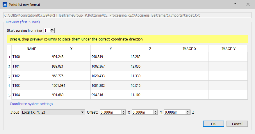
This dialog implements a general-purpose tool for parsing a text file (*.txt) with a list of points.
The assumption is that each row of the text file contains one point. The dialog allows you to define how you want to interpret the columns of the text file. In the example above, the first three columns contain the 3D coordinates of the point, column four and five contain the X and Y coordinates of the point in the range image (or in any image), and the sixth column contains the label of the points. Using the spin boxes (where is written "NAME", "X", "Y", "Z", "IMAGE X" or "IMAGE Y") in the bottom half of the dialog, you can customize the role of each column of the file.
This tool is used to parse point files in the following procedures and windows: Camera calibration, importing a polyline from .txt format, Geo-referentiation, Point list registration, and pre-registration.