Photo & Color
Reconstructor® provides several coloring tools to effectively manage the colorization of point clouds and meshes.
These tools can be classified according to the objects you want to color and the procedures you need to apply:
- Some color information is item intrinsic of point clouds and saved as a color layer
- Create projectors
- A mapping (on point clouds and meshes) of an image from external cameras is possible
Some color information is item intrinsic of point clouds and saved as a color layer:
|
To optimize the point clouds color's contrast by histogram stretching. Only single channel layer can be used (reflectance, gray scale layers). |
|
To create an artificial colorization for a given color layer of a point cloud. Color information can be scalar (e.g. reflectance, range, confidence) or vectorial (e.g. inclination). It's also possible to add layers from external images. The purpose of this command is to manage and create an artificial colorization for a given color layer of a point cloud. |
|
To add to the selected point cloud(s) an extra color layer, representing the altitude of the points with respect to one of the tree axes of the current UCS. |
|
To add to the point selected cloud(s) an extra color layer, representing the inclination of the points' normals with respect to a given plane that exists in the project. Suggestion: use it to classify points for a further vegetation removal. |
|
To create a color layer for structured point cloud by blending the images from selected projectors. |


Create projectors
|
This functions creates a projector in five different ways. |

A mapping (on point clouds and meshes) of an image from external cameras is possible
|
Images & calibration To calibrate images on point clouds and meshes and determine the external and intrinsic parameters of a camera: |
|
Create Panorama To create a create panorama (spherical 360° equi-rectangular) images starting from perspective images acquired with a camera centered on a 3D scanner head and rotating with them (*) |
|
Import georeferenced tif... Imports a georeferenced tiff (GeoTIFF) file from disk as an orthographic camera. |
|
Create texture map Opens a tool to texture map a selected mesh, given a texture view (a camera or a projector) and one or more projectors (calibrated images). |


(*) Note that when you import .zfs or .fls point clouds a spherical camera (projector) will be automatically created (see LineUp import Wizard settings).
|
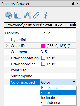
To look at point clouds’ color layers, select the point cloud from the project window and set the Color Mapped option in the Property Browser. |
See also our video tutorials on point clouds coloring.