Define project reference system
The command is available in the Data Management > LineUp Top menu.
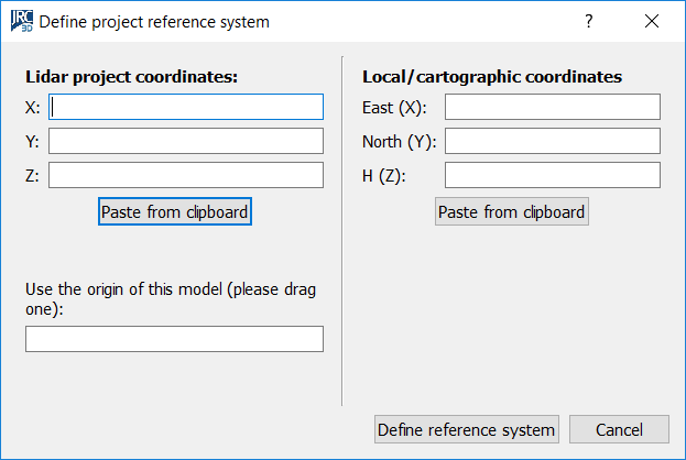
This dialog allows you to quickly define a new UCS by just specifying one point's coordinates in the old and in the new coordinate system.
You can input the coordinates in the “old” system in the left part of the dialog, and the “new” coordinates in the right part. The button Define reference system will create a new UCS for you as desired.
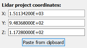
You can simply copy the coordinates of a point (as below written) and paste them with “Paste from clipboard” button filling the empty spaces.
P25 1511.342 948.368 117.280
For more sophisticated methods of georeferentiation, see also Georeferentiation.
![]() This tool creates a new UCS, based on the previous one and translated by an offset defined by the vector having the two points as extremes.
This tool creates a new UCS, based on the previous one and translated by an offset defined by the vector having the two points as extremes.