Point clouds georeferencing
|
|
This function allows the geo-referentiation of multiple scans. The workflow is divided in two steps:
|

Reference points selection dialog
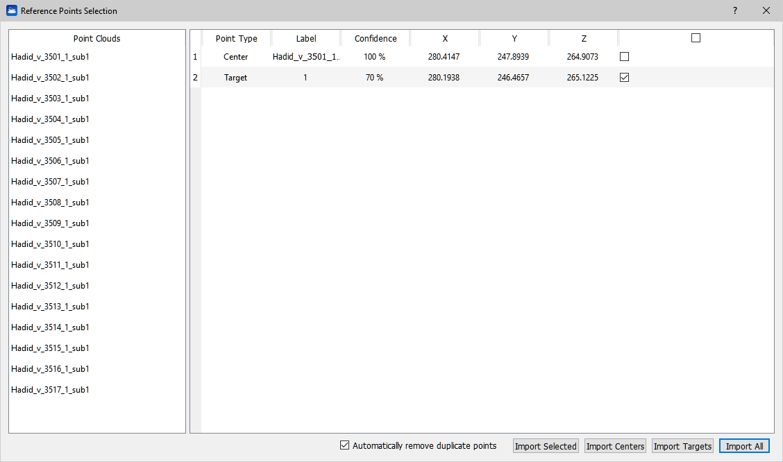
This dialog allows the selection of multiple reference points from the point clouds target and center points.
Target points can be automatically or manually set using the targets registration dialog or targets editor dialog tools.
The buttons in the bottom part of the dialog have the following functions:
- Automatically remove duplicate points: if two or more selected points are within a 0.2 meters distance between each other, only the higher confidence point is selected. This option can be used to pick only one target point if the same target was detected in more than one point cloud;
- Import selected: use only checked points for the geo-referencing step;
- Import centers: use only the point clouds center points for the geo-referencing step;
- Import targets: use only the point clouds target points for the geo-referencing step;
- Import points: use all the listed points for the geo-referencing step.
Scans georeferencing dialog
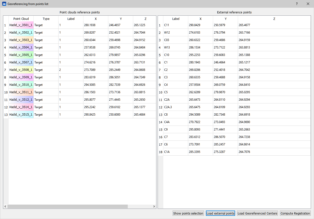
This dialog allows the user to load external reference points for geo-referencing scans using previous selected target points.
The buttons in the bottom part of the dialog have the following functions:
- Show points selection: opens the reference points selection dialog;
- Load external points: imports external point from a textual point list;
- Load georeferenced centers: imports the georeferenced center point of the point clouds if present. Georeferenced coordinates for the center point can be set automatically (depending on the format) or manually when importing the given point cloud;
- Compute registration: automatically finds the best matching points from the right and left lists and computes the alignment between them. See details in dedicated Compute Registration page.