Color with altitude
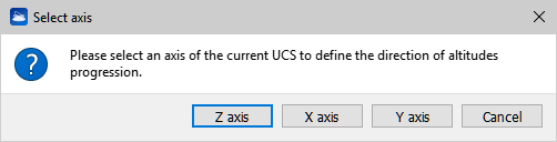
This tool works on any set of point clouds. It allows to add to the selected cloud(s) an extra color layer, representing the altitude of the points with respect to one of the tree axes of the current UCS.

After creating the color layer you can change the color scale in the Color Mapping window.