Heron Georeferencing
|
|
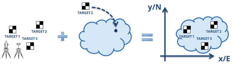
To georeference a Heron® point cloud by using the targets acquired and tagged during the on field survey (and also new targets picked in Reconstructor®). |
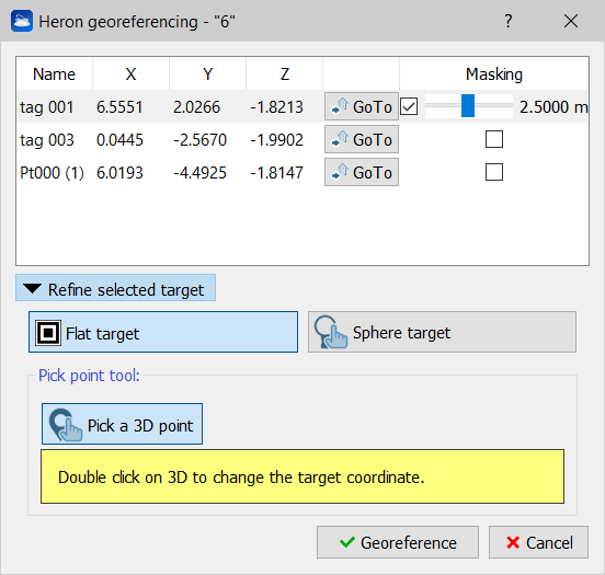
If pole tags are used, the positions of the targets are already located (on the ground control points), otherwise a refinement of the correct position of the targets (which can be flat or spherical and defined by fitting the point cloud) is necessary, because the tags are positioned in the center of the laser head.
Click GoTo to focus the visualization on the related target.
If Masking is selected, only a small spherical volume will be displayed around the target position; by sliding the cursor you can change its radius to display more or less points and better define the target position, without too much useless information covering the areas of interest.
Remember to unflag Masking at the end of the process, to reset the point cloud visualization.
Refine selected target
Find out the commands by selecting the black arrow and choose the kind of target you are refining.
Flat target (or generic point used as targets)
|
|
To refine the target position, identify it in the point cloud and double click (LMB) on its center to to define the new localization and to change the coordinates of the tags (as you will see in the table). |
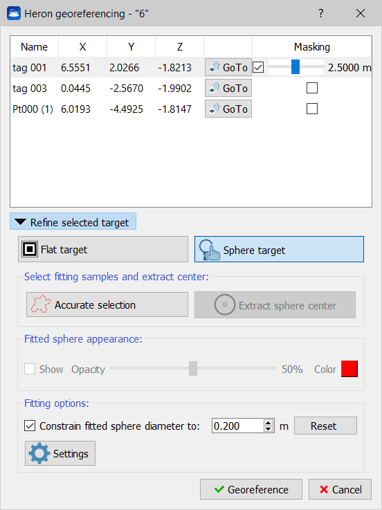
Sphere target
|
|
To refine the target position by detecting the sphere's center, select the point cloud area occupied by the sphere (by the Accurate selection) and then extract the sphere center (by the homonym command). The sphere is extracted by fitting of the point cloud and by setting its diameter. The opacity and the color of the item sphere could be managed. |
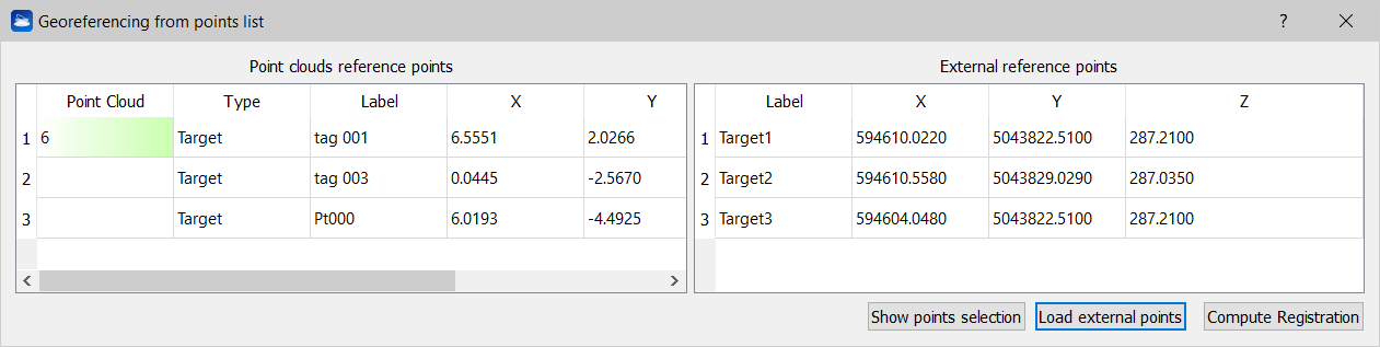
After refining the target positions click on Georeference.
Select the targets to be used to georeference the point cloud, Load (1) an external file (.txt) containing the surveyed targets coordinates and compute (2) the rototranslation process to georeference the point cloud.
See Georeferencing for further details about georeferencing processes.