3. 3D Model georeferencing
Using the Point list registration command in Reconstructor® environment, you can register a list of points, named moving points, against another list of points that you consider as reference (these last points can be geo-referenced). So you can take some points on the model and register it using geo-referenced coordinates of the same points.
Here the process:
- Moving points (in the left half of the dialog): you can load a text file with listed points or you can copy the points listed in the project
- Reference points: (in the right half of the dialog): you can load the reference points from a text file
- press Compute to register the points by coupling them. A dialog appears, asking whether you want to register the points by coupling them according to their labels, or by trying out all the possible pair combinations to find the best. The first option is much faster but it assumes that you are sure about how to match your points. After you have selected either Match names or Best fit, you can refine and make use of the results of the registration, in the Registration report dialog.
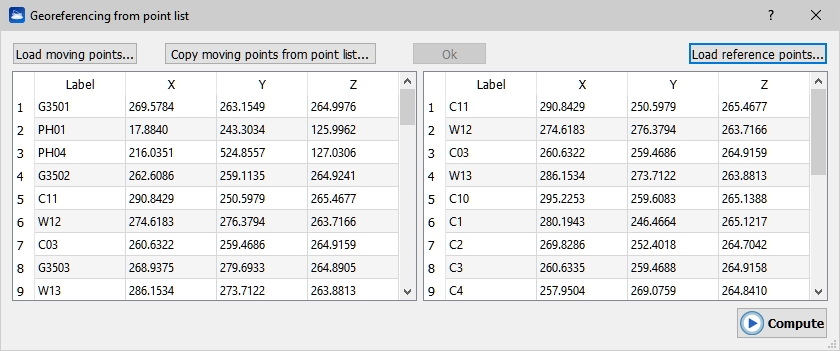
Note: to start the registration, it is not necessary for the left table to contain as many points as the right table.
It’s suggested to save the scans position before to move them in the 3D space, so it will be easy to recover the previous position in case of a bad displacement or alignment (see also Restore a Pose).
For more details see Georeferencing from point list page.